Town Trails


With our series of heritage Town Trails we hope to encourage an interest in the history of the Lamorbey and Sidcup districts.
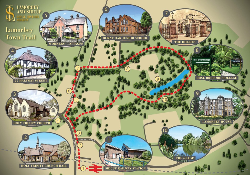
The Lamorbey Town Trail describes a walk around Lamorbey, with a beautifully-illustrated map and numbered points from Sidcup Railway Station, along Halfway Street, Burnt Oak Lane and through The Glade.
The Sidcup Town Trail begins at the former Police Station and follows a route along the High Street, around St John's Church and up to Sidcup Place and Queen Mary's Hospital.
Both Town Trails can be downloaded below.
Town Trail Lamorbey.pdf
Adobe Acrobat document [2.0 MB]
Adobe Acrobat document [2.0 MB]
Town Trail Sidcup.pdf
Adobe Acrobat document [6.9 MB]
Adobe Acrobat document [6.9 MB]
You may also be interested to see our Family Poppy Trail to see important points relating to the Great War in Sidcup as part of our Great War Pageant. The Family Poppy Trail can be seen here.
